Publication and freshness
This article predates our verified-timestamp system; its original publication date was not reliably recorded, so no publication or freshness date is claimed.
Byline record
Editorial Desk byline. No personal contributor profile is claimed.
Sources and method
Inspect the primary-source links in the article and our research method. Changing rules must be rechecked at the official source.
Separate review record
No separately stored fact-checker or fact-check date is published for this article. Edit history: no recorded revisions since revision tracking began.
A practical state-by-state guide to driving Route 66 from Chicago to the Santa Monica Pier — signature stops, trip length, best season, rental and visa notes, plus the 2026 centennial.
Few road trips carry as much romance as Route 66. The "Mother Road" once ran roughly 2,448 miles from downtown Chicago to the Pacific at Santa Monica, cutting across eight states and the whole middle of America. Along the way it gave the country diners, motels, neon signs, and a particular idea of freedom — the open road with nothing but desert and possibility ahead.
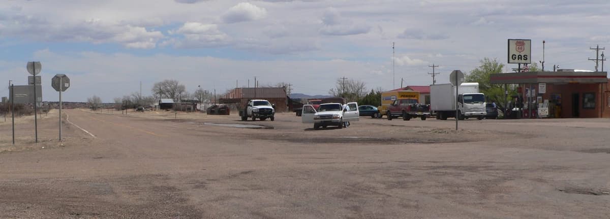
Route 66 was decommissioned as an official US highway in 1985, replaced by the faster Interstates that bypass it. But the road did not disappear. Long, drivable stretches survive as "Historic Route 66," signed and kept alive by the small towns that grew up beside it. Driving it today is part travel, part time-travel: you follow the old alignments where you can, dip onto the Interstate where the old road has vanished, and collect a string of eccentric stops in between.
This guide walks the route west, state by state, from the Chicago start sign to the Santa Monica Pier — how long to give yourself, when to go, how to handle the rental car and the long desert gaps, what it costs, and a short note for Pakistani travellers on the US visa and driving permit. 2026 is also a milestone year, explained below.
Quick facts
| Route | Chicago, Illinois → Santa Monica, California |
| Distance | ~2,448 miles (~3,940 km) of historic alignments |
| States crossed | Illinois, Missouri, Kansas, Oklahoma, Texas, New Mexico, Arizona, California |
| Direction | Traditionally driven east-to-west (Chicago → LA) |
| Suggested time | ~14 days is the sweet spot; 10–21 days workable |
| Daily driving | Roughly 150–250 miles / 3–5 hours, leaving time for stops |
| Best time | Mid-spring and early autumn (Apr–May, Sep–Oct) |
| Avoid | Desert stretches at peak summer (Jun–Aug heat) |
| Accommodation | Classic roadside motels; chains in bigger towns |
| Big 2026 note | Route 66 turns 100 — centennial events run all year |
Why drive Route 66
Route 66 was established on 11 November 1926 as one of the original US numbered highways, linking Chicago to Los Angeles, according to Wikipedia's overview of U.S. Route 66. Over the next decades it became the road of the American imagination — the path of Dust Bowl migrants heading west in the 1930s, the post-war family holiday, the song ("get your kicks on Route 66"), and a thousand roadside businesses competing for passing trade.
What makes the drive special today is not a single landmark but the accumulation of small ones: a 1950s motel with its neon still buzzing, a roadside giant, a faded gas station turned museum, a diner that has served pie since before the Interstate existed. Between them you pass through real American geography — prairie, the Mississippi, the high plains, red-rock desert, mountains, and finally the California coast. It is the best possible introduction to the scale and variety of the United States, done at the pace of a back road rather than a freeway. Part of the fun is the navigation itself: following the brown "Historic Route 66" signs and a good map, choosing the slow old alignment over the fast I-40 or I-44 whenever the original road still runs.
Best time to drive
The route crosses very different climates, so timing matters more than on most trips.
- Spring (April–May) and early autumn (September–October) are the sweet spot: mild temperatures across the plains and deserts, open businesses, and lighter crowds.
- Summer (June–August) brings brutal heat to the desert sections of New Mexico, Arizona, and the Mojave in California, where daytime temperatures regularly exceed 38–40°C. It is also the busiest and most expensive season. If you must drive in summer, cross the desert early in the morning and carry extra water.
- Winter (November–March) is quiet and cheap, but the high country around Flagstaff, Arizona can get snow and ice, and some seasonal attractions and small motels close or reduce hours.
Reputable planners consistently point to late spring and early fall as the ideal window for comfort and open roadside businesses; see this Route 66 planning guide for a season-by-season view. One important 2026 note: because it is the highway's centennial, towns along the route are hosting events all year (see the centennial section below), which can push up demand and motel prices in peak weeks — book ahead.
How long to give yourself
Driven non-stop, Route 66 is only around 33 hours behind the wheel — but nobody should drive it that way. The whole point is the stops.
- About 14 days is the widely recommended length: roughly 150–200 miles a day, leaving real time to explore towns, museums, and detours.
- 10–12 days is the practical minimum if your leave is tight; you will be moving faster and skipping some side trips.
- 2–3 weeks lets you slow right down, add the Grand Canyon and Santa Fe detours comfortably, and never feel rushed.
For Pakistani travellers flying in, remember to add jet-lag recovery and your flight days on top — realistically a full Route 66 trip is a 2.5–3 week holiday door to door.
The route, state by state
Illinois — the Chicago start
The official starting point is in downtown Chicago, marked by a "Route 66 — Begin" sign near Grant Park on Adams Street. Spend a day in the city first, then head southwest, picking up old-road towns, classic diners (the Launching Pad with its Gemini Giant near Wilmington is a favourite), and small Route 66 museums on the way to the Mississippi.
Missouri — Gateway Arch, St Louis
Cross the Mississippi into Missouri and you reach St Louis and its unmistakable Gateway Arch — at 630 feet (192 m) the tallest man-made monument in the US, now a national park. A tram carries visitors to the top; tickets sell out and are best booked in advance via the official Gateway Arch site. Beyond St Louis, Missouri rewards slow driving with old bridges, caves, and the rolling Ozarks toward Springfield — the city chosen to host the national kickoff of the 2026 centennial.
Kansas — the shortest stretch
Route 66 only clips the southeast corner of Kansas for about 13 miles, but it is a beautifully preserved 13 miles, almost entirely on the original alignment through the towns of Galena, Riverton, and Baxter Springs. It is a quick but charming crossing.
Oklahoma — the heart of the road
Oklahoma has more drivable original Route 66 than any other state. Highlights include the Blue Whale of Catoosa, the art-deco architecture of Tulsa, the Oklahoma Route 66 Museum in Clinton, and a string of small towns where the road still feels like 1955. Oklahoma City makes a natural overnight.
Texas — Cadillac Ranch, Amarillo
The road crosses the Texas Panhandle to Amarillo, home of Cadillac Ranch — ten old Cadillacs half-buried nose-down in a field, endlessly repainted by visitors. It is free, open 24/7, and you are encouraged to bring spray paint. Nearby, the Midpoint Café in Adrian marks the symbolic halfway point of the whole route.
New Mexico — Tucumcari, and the Santa Fe / Albuquerque detour
In New Mexico the scenery turns to high desert and red rock. Tucumcari is the classic neon-motel town — a fine place to stay in a restored 1950s motor court. The road runs on to Albuquerque, whose Central Avenue is lined with original Route 66 signage. A worthwhile detour follows the older 1926–1937 alignment up to Santa Fe, the historic state capital, before rejoining the main route.
Arizona — Petrified Forest, Seligman, Oatman, and the Grand Canyon detour
Arizona is many travellers' favourite stretch. The road skirts the Petrified Forest National Park — the only national park in the system that contains a section of Historic Route 66, marked today by a line of telegraph poles and an old car, per the National Park Service. Further west, Seligman is the town that helped save Historic Route 66 in the 1980s and is now a delightful time capsule. From around Williams or Flagstaff you can make the essential Grand Canyon detour (about 1–1.5 hours north). Near the Nevada border, the old road climbs over the Black Mountains to Oatman, a former mining town where wild burros wander the main street.
California — the Mojave to the Santa Monica Pier
Crossing into California, the road runs through the Mojave Desert — the longest, hottest, emptiest stretch, with classic stops like Roy's Motel and Café in Amboy — before descending through San Bernardino and into Los Angeles. The traditional finish line is the Santa Monica Pier, where an "End of the Trail" sign marks the Pacific. Dip your toes in the ocean: you have crossed a continent.
Renting the car and the one-way drop
Most international visitors fly into Chicago, rent a car, and fly home from Los Angeles — which means a one-way rental. Two things to plan for:
- One-way drop fees. Picking up in one city and dropping in another usually adds a one-way fee on top of the daily rate. It varies by company and season, so compare quotes and book early; sometimes a fly-drive package is cheaper than arranging it piecemeal.
- Vehicle choice. A comfortable mid-size car or small SUV with good air-conditioning is ideal for the desert. A convertible is romantic but punishing in summer heat. Confirm the rental allows the full multi-state, one-way itinerary.
Check insurance carefully — US rentals often quote a low base rate with significant extra charges for collision and liability cover, so read what is included. You can compare your own travel insurance options before you go rather than relying solely on the rental desk.
Costs & booking notes
Route 66 can be done on a wide range of budgets. As a rough guide for two people sharing, expect daily costs in these bands:
- Accommodation: classic roadside motels often run around US$70–130 per night; chain hotels in bigger cities cost more, especially in 2026's busy centennial weeks.
- Fuel: budget for the full ~2,400+ miles plus detours; fuel is a major line item on a trip this long.
- Food: diners and cafés are affordable; a sit-down meal is typically modest, and roadside snacks are cheap.
- Attractions: many icons (Cadillac Ranch, the start/end signs, much of the scenery) are free; paid stops like the Gateway Arch tram or Grand Canyon entry are the exceptions.
The single biggest variable is the air ticket. Compare fares from Karachi, Lahore, or Islamabad on flight search well in advance — there are no direct flights from Pakistan to the US, so expect one or two stops via the Gulf, Europe, or Turkey. Booking flights and motels early is the best way to control the total, and our trip planner can help you sequence the cities and overnight stops.
Safety & practical tips
Route 66 is a safe and well-travelled drive, but the desert sections demand respect.
- Fuel up early. In the western states, gas stations can be far apart. Refill when you hit half a tank rather than waiting for empty, especially in the Mojave and around Oatman.
- Carry water. Always keep several litres of drinking water in the car when crossing desert stretches, plus snacks, in case of a breakdown or delay.
- Mind the heat. Cross desert sections early in the day in summer; never leave anyone (or pets) in a parked car.
- Distances and fatigue. The driving is easy but long. Swap drivers, take breaks, and do not push past dusk on unfamiliar old alignments.
- Navigation. Use a dedicated Route 66 map or app alongside your phone GPS — standard satnav will route you onto the Interstate and skip the historic alignments you came for.
- Have a phone plan. Buy a US SIM or eSIM on arrival; coverage is generally good but patchy in remote desert.
Itinerary ideas and detours
The two classic add-ons are easy to slot in:
- Grand Canyon (Arizona): detour north from Williams or Flagstaff for at least a half-day — for most people, the highlight of the whole trip.
- Santa Fe (New Mexico): follow the original pre-1937 alignment for adobe architecture, art, and history.
If you love this kind of slow, landmark-rich travel, you might also enjoy our guide to the best archaeological sites in the world, or — for choosing exactly when to travel anywhere — our month-by-month weather and destinations guide.
The 2026 centennial
Route 66 was established in 1926, so 2026 marks its 100th anniversary, confirmed by the official U.S. Route 66 Centennial organisation. This is not a single date but a year-long programme of events spread across all eight states — parades, festivals, classic-car rallies, and town celebrations — with a national kickoff hosted in Springfield, Missouri. It is a wonderful year to make the drive, but be aware that demand and motel prices rise around the bigger events, so book accommodation and your rental car well ahead if you travel in 2026.
Notes for Pakistani travellers
There are two things to sort out before a US road trip from Pakistan.
The visa. US travel needs a B1/B2 visitor (tourist) visa, applied for via the official US Travel Docs Pakistan portal: complete the DS-160 form, pay the application fee, and attend an interview at the embassy or consulate. Apply months ahead — appointment waits can be long. Your passport should be valid for at least six months beyond your stay. See our visa services page for help getting started.
The driving permit. To drive in the US you should carry your Pakistani driving licence plus an International Driving Permit (IDP), which is essentially a recognised translation of your licence. Crucially, the IDP must be issued in your home country — so obtain your IDP in Pakistan before you fly, as the US does not issue them to visitors. Some rental companies and police checks will ask for it, per US State Department driving guidance.
Conclusion
Route 66 is less a single attraction than a 2,400-mile cross-section of America, stitched together from neon motels, desert horizons, oddball roadside giants, and eight very different states. Give it roughly two weeks, drive it in spring or autumn, follow the old alignments wherever they survive, and respect the long desert gaps — and you will come away with the classic American road trip. With 2026 marking the road's centennial, there has rarely been a better year to get your kicks on Route 66.
FAQ
How long does it take to drive Route 66?
Driven non-stop it is only about 33 hours behind the wheel, but a proper trip with stops takes around 14 days. Ten to twelve days is a tight minimum, and two to three weeks lets you add detours like the Grand Canyon and Santa Fe comfortably.
What is the best time of year to drive Route 66?
Mid-spring (April–May) and early autumn (September–October) offer mild weather across the plains and deserts, open roadside businesses, and lighter crowds. Avoid peak summer in the desert states because of extreme heat, and watch for winter snow in the Arizona high country.
Which direction should I drive Route 66?
Most people drive east to west, from Chicago to Santa Monica, following the historic flow of the road and finishing dramatically at the Pacific. It also keeps the afternoon sun behind you more often in the desert.
Do I need an International Driving Permit to drive Route 66?
Yes — carry your Pakistani driving licence together with an International Driving Permit (IDP), and obtain the IDP in Pakistan before you travel, because the US does not issue them to visitors. A B1/B2 visitor visa is also required for the trip itself.
Is Route 66 still a real road?
Route 66 was decommissioned as an official US highway in 1985, but long stretches survive and are signed as "Historic Route 66." You follow these old alignments where they remain and use the modern Interstates (I-44, I-40 and others) where the original road has disappeared.
Is 2026 a special year for Route 66?
Yes. Route 66 was established in 1926, so 2026 is its 100th anniversary (centennial), marked by year-long events across all eight states. It is a great year to drive it, but expect higher demand and motel prices around major events.
Written by
Travel.pk Editorial Desk
Researches and edits practical travel guidance for people planning journeys from Pakistan.
How we research and edit →Comments
Loading comments…